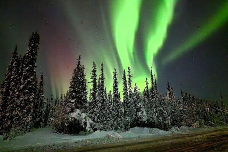
Driving the Dalton Highway: 20+ Expert Tips & Safety Guide

Driving the Dalton Highway is one of the most epic expeditions into the raw, remote wilderness of northern Alaska (not to be too cheesy). My husband, Sean, and I tackled the entire stretch, starting from Tok to Fairbanks, up to Coldfoot, and all the way to the industrial outpost of Prudhoe Bay on the Arctic Ocean.
Along the way, we slept in the back of our car, watched wild muskoxen graze among the tundra, took a swim in the Arctic Ocean after our background checks were cleared to cross the oil fields, and even witnessed the aftermath of a near-fatal accident which was a sobering reminder of how unforgiving this route can be.
The Dalton is one of the most remote highways in North America, and it demands serious preparation, respect, and an adventurous spirit. With few services, long stretches between fuel stops, and unpredictable road conditions, it’s not a drive you want to take lightly.
But if you’re up for the challenge, the rewards are massive: sweeping Arctic landscapes, surreal solitude, and the unmatched bragging rights of having reached the top of the world by road!
This guide to driving the Dalton Highway is your #1 resource because it’s based on real experience, not just research. We’ve driven the stretch of road twice now, and are going to provide you with an honest look into what it may take to get you there!
We’ve provided you a map of the best stops along the way, the only place available for gas and food, and the company that will allow you to get to the Arctic Ocean. We’ve also compiled everything you need to know for prepping your vehicle, what to pack, what to watch for, and what most travelers get wrong.
We’ve even included a list of our top advice and tips so you know exactly what you’re getting into before you start the drive! Whether you’re planning a quick Arctic Circle jaunt or braving the full 414-mile stretch to Deadhorse, we’ve got you covered with practical, honest, and field-tested advice.
Mile-by-Mile Guide to Driving the Dalton Highway
Mile 0: Start in Fairbanks
Fuel up completely. In fact, if you have an exterior cage or spot where you can tie up an extra fuel jug, do it! This is one of your last chances for reliable gas until Coldfoot, 254 miles away.
Make sure your spare tire is solid and you have all of the equipment you need to change a flat (i.e. a tire jack and lug wrench), your fluids are topped off, and there are no lights on your dashboard.
Stock your vehicle with enough water to ideally last you 3 days (about 2 liters per day per person), plenty of dry food, and some warm layers and blankets. Paper maps are also good to have on hand in case your GPS stops working. Ours worked fine throughout the drive, but we met several travelers who said theirs stopped working after they reached the Arctic Circle.
Fairbanks has all the supplies you could possibly need for driving the Dalton Highway, so take advantage before heading about 80 miles along the Elliott Highway into the wild.
Mile 80: Elliott-Dalton Highway Junction
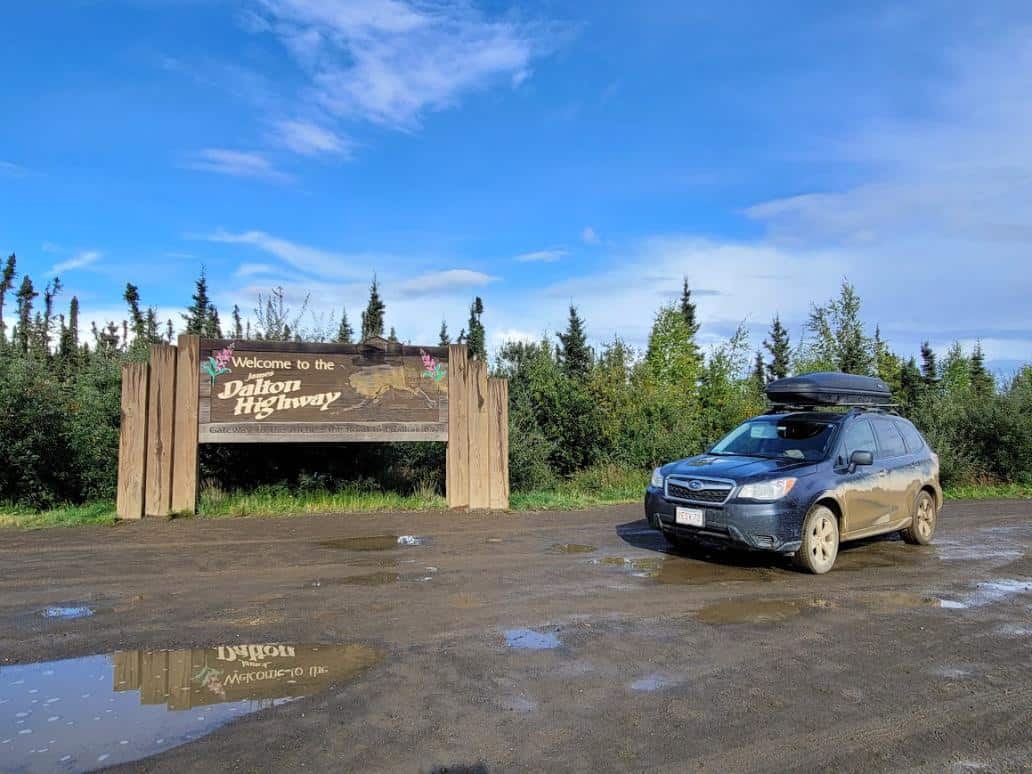
This is where the adventure truly begins – the official start of the Dalton Highway! Be sure to grab a quick photo with the welcome sign marking the beginning of the James W. Dalton Highway.
It’s practically a rite of passage and a positive attitude here sets the tone for the wild ride you have ahead of you.
Mile 136 (Officially Mile 56): Yukon River Crossing
While you technically will have driven about 135 miles at this point, the Yukon River crossing is located about 56 miles into the official Dalton Highway, so it’s called “Mile Post 56”.
Here you’ll cross the mighty Yukon River on a long wooden bridge (officially known as the
Yukon River bridge) which you’ll want to have your camera ready for. The Yukon River Camp nearby offers fuel and food, but hours can be unpredictable, so don’t count on it as your only stop.
If you’ve got time, take a moment to stretch your legs and scan the riverbanks for moose. Bald eagles also like to hang around here, especially near the treetops!
Mile 178 (Officially Mile 98): Finger Mountain & Toilet Break!
Just 42 miles north of the Yukon River Camp is a structure known as Finger Mountain; a quirky granite spire rising out of the tundra that makes for a quick, but fun photo stop.
There’s a rest area with vault toilets, but be sure you have your own toilet paper and hand sanitizer. There’s also a short interpretive trail that’s worth walking to if you need a little more time to stretch your legs.
✅ Pro Tip: Bring binoculars! Caribou are often seen grazing in the open tundra nearby, especially in summer.
Mile 194 (Officially Mile 115): Arctic Circle Sign
Just 17.4 miles from Finger Mountain is the official line crossing into the Arctic Circle! There’s a pull-off here with a big wooden sign that begs for a photo.
Facilities are simple (just a vault toilet and a few picnic tables), but the feeling of crossing into the Arctic is unmatched. Keep an eye out for arctic hares and red foxes darting through the brush.
✅ Pro Tip: If you aren’t feeling well enough to keep driving, stop into BLM Arctic Circle Campground. It’s $12 a night (cash only) that you place in a drop box and the facilities are pretty well maintained. We’ve also heard that some campers even received an official Arctic Circle certificate from the Camp Host after arrival!

Mile 211 (Officially Mile 133): Gobblers Knob
Just 16.8 miles after the Arctic Circle sign is a little summit offering one of the best panoramic views of the Brooks Range! Known as Gobblers Knob, it’s a great spot for birdwatching for hawks and eagles, and on a clear day, the visibility here is jaw-dropping.
It’s also good to know for those looking to get to the Gates of the Arctic National Park, you can get on the Bettles-Prospect Winter Trail, also known as Bettles Winter Road, and drive for about 30 miles west. The road is located just 3.6 miles past Gobblers Knob.
But, this road is very seasonal and is only passable when there is enough snow to protect the fragile tundra underneath. The town of Bettles is located off the road system, so this 30-mile “road” will take you nearly 3 hours to get through!
Mile 254 (Officially Mile 176): Coldfoot Camp
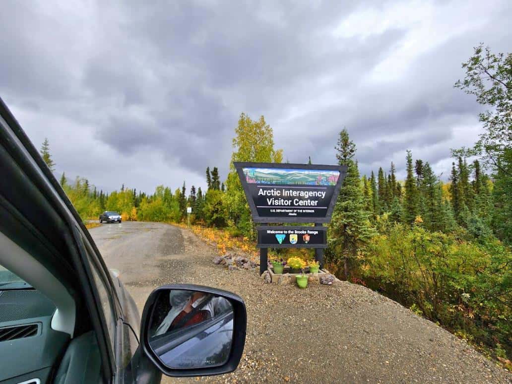
Welcome to Coldfoot, the northernmost truck stop in the U.S.! This is also where you’ll find the Arctic Interagency Visitor Center which has some cool exhibits about the Arctic Circle that you can check out.
This is the most reliable place for gas, a hot meal, and a real bed if you’re craving something softer than your car seat. Rooms need to be booked in advance since they often sell out months beforehand, which is why we ended up sleeping in our car in the parking lot.
The Coldfoot Camp has a cafe, post office, visitor center, and even a bar. Moose are often seen just outside of town, and foxes like to run through the muddy parking lot surrounding the eatery!
Keep in mind that this isn’t a real restaurant. Food options are limited and the cooks only make a few set dishes per day. There are no special orders and the food quality isn’t what you would get in the major cities.
✅ Pro Tip: Keep your expectations low, but if they have the mac and cheese, try it!
Mile 301 (Officially Mile 223): Open Tundra
You’re in the thick of it now! This is where civilization doesn’t exist and you may not see anyone for hours. Keep your eyes peeled for muskoxen, caribou, arctic foxes, arctic hares, golden and bald eagles, and so forth.
You’ll be going up and down hills with nothing but mountain and river views. Keep your camera ready and go slow, wildlife are known to run into the road around here.
✅ Pro Tip: Once you’ve driven about 312 miles outside of Fairbanks, you’ll be entering the North Slope Borough of Alaska!
Mile 325 (Officially Mile 247): Atigun Pass
You’ll start climbing into the heart of the Brooks Range here. Atigun Pass is the highest road pass in Alaska at 4,739 feet, and it’s truly one of the most breathtaking places on the highway.
The road can be narrow and steep, especially in bad weather, so take it slow. This is prime territory for spotting Dall sheep on the cliffs and even the occasional grizzly bear!
Mile 352 (Officially Mile 273): Galbraith Lake
Galbraith Lake lies in a wide glacial valley and reflects the nearby peaks beautifully, especially early in the morning or near sunset.
Primitive campsites are available here if you’re ready to rough it. This area is known for muskoxen and the occasional wolf sighting.
✅ Pro Tip: Whenever leaving your vehicle, always keep the doors shut and your bear spray on your person. You are in the remote wilds of untouched Alaska, and the wildlife are not used to seeing humans here. They may react more aggressively than those closer to civilized regions, so be prepared for wildlife interactions.

Mile 352–492: Northern Foothills
As the mountains begin to fall away, you’ll enter rolling tundra and low hills. This section is wide open and full of wildlife opportunities with muskoxen, arctic foxes, moose, and caribou can be seen wandering the landscape. Bring binoculars and keep your camera ready.
This 140-mile stretch may seem lonely and barren, but this is the interior of the Arctic Circle. You’re officially one of the very few people to ever make it this deep into Alaska’s tundra, so take plenty of photos!
Mile 492 (Officially Mile 414): Deadhorse
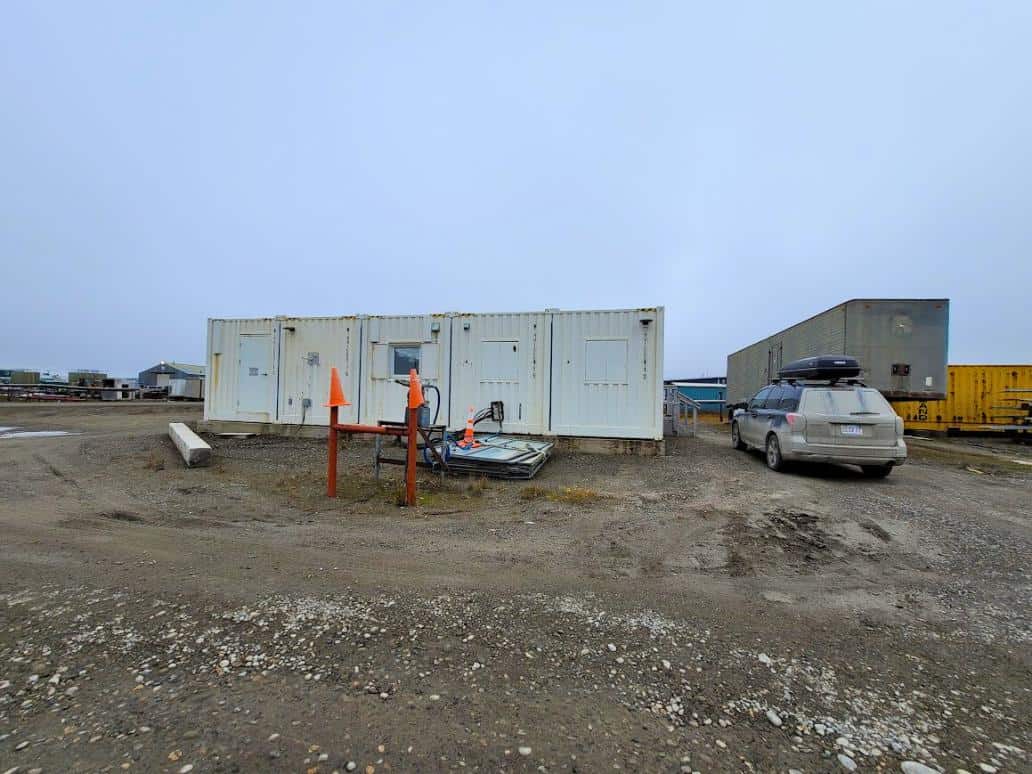
Deadhorse is the final outpost before Prudhoe Bay, and while it’s not exactly charming, it’s functional.
You’ll find fuel, meals, and lodging here. If you want to reach the Arctic Ocean, you’ll need to book an oilfield tour in advance – it’s the only way to legally access the shoreline.
Mile 502: Prudhoe Bay / Arctic Ocean Access
You did it! This is the northernmost drivable point in the U.S., and it feels like another planet. If you take the Arctic Ocean Shuttle, you’ll get the chance to dip your toes (or your whole self, if you’re brave!) into the Arctic Ocean.
Keep in mind that you will be required to undergo a background check prior to confirming your reservation, so it’s best to book your trip 24 hours in advance.
Wildlife here includes snowy owls, arctic foxes, and tundra swans. Once the ice reaches the shoreline, polar bears can even be spotted on rare occasions, however, by this time, driving the Dalton Highway will become nearly impossible due to perilous snowy, icy conditions.
✅ Pro Tip: Many 18-wheelers often end up flipping once the snow reaches the ground, so we strongly advise against attempting this highway road trip after early September when snow is more likely to fall.

Driving the Dalton Highway Map
Every spot we mentioned above has been marked on the map below! You may notice that Google Maps often says driving the Dalton Highway from Fairbanks to Deadhorse will take approximately 10.5 hours, but this isn’t the case for most.
We drove straight through without sleeping on once occasion, with only 2 quick bathroom breaks, and the drive still took us over 13 hours!
The drive can be painfully slow at points due to horrific road conditions from washouts, massive potholes the size of your wheel, and icy conditions even in August.
Assume the drive will take you 13-14 hours with few stops if you really want to do the drive in one day, but from our experience, it’s best to sleep for a night at either Coldfoot Camp or in one of the other campgrounds along the drive.
✅ Pro Tip: Nobody will bother you if you pull over on the side of the road and sleep. Just make sure you don’t park on a blind corner or at the top or bottom of a hill where someone may not see you!
Expert Tips for Driving the Dalton Highway
- Fuel Up at Every Opportunity
Gas stations are few and far between, mainly in Fairbanks, Yukon River Camp (if open), Coldfoot, and Deadhorse. Even if you’re half full, fill up when you can. If you run out of gas, it could be days before someone is able to help you! - Bring at Least One Full-Size Spare Tire (Two is Better)
The gravel and shale can shred tires, and towing costs out here are astronomical. You won’t find tire repair shops between Fairbanks and Deadhorse, so be sure your spare tire is in tip-top shape, you have the necessary equipment to change a tire, and you know how to change a tire! - Use a Vehicle with High Clearance
The road conditions vary constantly. Expect potholes, washboard gravel, soft shoulders, and massive, deep puddles. A high-clearance, 4WD vehicle will save you stress and damage. - Carry a Satellite Phone or Emergency Beacon
There’s zero cell service past Mile 60. If you break down or have an emergency, you’ll need a way to call for help, especially in areas with little passing traffic. - Pack Plenty of Food and Water
Plan for at least one extra day’s worth in case of breakdowns or weather delays. There are no grocery stores along the route, just basic meals at Coldfoot and Deadhorse, so you need to stock up in Fairbanks. - Start Early in the Day
This gives you plenty of daylight to spot wildlife, navigate rough sections, and handle unexpected stops without rushing. Driving the Dalton Highway in the dark is a BIG no-no, so plan on an early start and an early end each day of your drive. - Drive Slow and Yield to Trucks
The Dalton was built for the Trans-Alaska Pipeline, and commercial truckers still dominate this route. Pull over and yield – they’ll appreciate it (and you’ll avoid cracked windshields from flying rocks).
You won’t have much of an option since they’ll take up about 85% of the road anyway. - Cover Your Headlights with Film or Tape
Protect them from flying rocks by adding a removable clear film or heavy-duty tape. Replacements are hard to come by outside of Fairbanks. - Watch for Wildlife Constantly
Muskoxen, foxes, caribou, moose, Dall sheep, and even grizzlies frequent the highway corridor. Keep your camera ready, but keep your distance and watch for them in the road! - Don’t Rely on GPS
Navigation apps won’t help much once you’re past the Yukon River. We’ve always had good luck using our Google location which even worked on the Dalton, but it’s definitely not a reliable way to complete the drive safely. Bring detailed paper maps or download offline maps in advance. - Make a Wildlife Checklist
It’s a fun way to engage with the trip and it helps you slow down and stay observant. You might see more species than you expected! - Keep an Eye on the Weather
Storms can roll in fast, especially around Atigun Pass. Rain can turn dirt sections into slick mud pits, and snow can fall even in summer, so when you’re approaching steep roads, watch the conditions closely. - Layer Your Clothing and Pack Cold-Weather Gear
Even in July, temps can dip below freezing at elevation or near Prudhoe Bay. Bring a warm hat, gloves, rain gear, and an insulated jacket. - Know That Help is Not Just a Phone Call Away
Towing from Prudhoe Bay can cost several thousand dollars. Be self-sufficient, bring tools, a jack, and a repair kit, and know how to use them. Even if someone does make a call for you, it’s not uncommon for help not to show up for 2-3 days. - Sleep in Your Car? Plan Ahead.
We did it and it’s doable, but cold! Bring warm sleeping bags and be ready to wake up and turn your car on to get the heat going, if necessary. Also, watch where you park! Some spots are soft and become extremely slick when it rains, causing you to slide even when the car is off. - Pack a Real First Aid Kit and Prescription Meds
You’re hours away from professional medical care, so bring anything you might need for minor injuries or unexpected health issues. We always travel around Alaska with a splint, triangular arm wrap, antibiotic cream, burn ointment, band aids, and basic medications. - Stop Often and Soak It In
The Dalton Highway is an adventure in itself. Give yourself time to take photos, watch the wildlife, enjoy the silence, and appreciate the remoteness. Taking the drive slower will also decrease your risk of accidents, so it’s a win-win! - Be Prepared to Turn Around
Not all vehicles (or travelers) make it to Prudhoe Bay. Weather, mechanical issues, or road conditions may force you to reroute. That’s part of the adventure, so don’t force the journey if there are several signs saying you should turn back. - Respect the Land and the Alaska Pipeline
The pipeline runs alongside much of the route. You can look, but don’t touch or cross it! Not only is it illegal, but it’s also best to follow Leave No Trace principles, and respect Indigenous land and communities. - Double-Check Permits and Tours for Arctic Ocean Access
You can’t drive all the way to the ocean without booking a tour through the oilfields in advance. Plan this at least 24–48 hours ahead so you can ensure availability and give yourself enough time for them to complete your background check!

Our Dalton Highway Horror Story
We passed a man who was driving the Dalton Highway on an on-off dirt bike who had been speeding and flipped his bike just minutes before we saw him. We found him in the hedges along the road, his handlebars were bent and we couldn’t get the bike to start.
All of his food and belongings were scattered along the highway. He badly injured his leg, didn’t speak English, and he had no way of communicating via satellite phone.
We offered him a ride to Coldfoot as many times as we could using our Google Translate app, but he didn’t want to leave his bike or his belongings. We practically begged him to get in our car, but he again refused. We didn’t see him again for 5 days. He sat on the side of the road for 5 days until an RV went by that was able to tie up his bike to their trailer.
He was limping his way around Coldfoot Camp sipping on water because he was severely dehydrated and could barely keep food down. There are no medical services outside of Deadhorse or Fairbanks, and being halfway between the two, he was out of luck until someone could drive him the rest of the way in either direction.
So, when we say this drive is no joke and you need to be properly prepared, please listen! Have a satellite phone, have extra food and water, bring warm layers, and be prepared to be stranded for at least 3 days.
An average of 40 people die every year on the Dalton Highway from head-on car crashes, with motorcyclists being among the majority. Truckers flip their vehicles and tourists are too busy looking at the view to notice the 8-foot drop where the road washed out.
The Dalton Highway is consistently listed in the top 15 most dangerous highways in the world, so please take it seriously.
Dalton Highway FAQ
Why is the Dalton Highway so dangerous?
The Dalton Highway has a reputation for being one of the most dangerous roads in the U.S., and honestly, it’s earned.
The danger isn’t about sharp turns or cliffs. It’s about isolation, rough road conditions, and lack of services. Most of the road is gravel and constantly changing with weather and heavy truck traffic. There are very few places to get fuel, food, or help, and cell service is basically nonexistent past the Yukon River.
Tire blowouts are common. Weather can change in minutes, especially around Atigun Pass. And if something goes wrong, it might be days before another vehicle comes along, especially in the off-season.
Add in fast-moving semi-trucks and slippery conditions, and it’s understandable why it’s rated one of the most dangerous highways in North America!
Is it worth driving the Dalton Highway?
A road trip on the Dalton Highway is worth it if you’re up for an adventure. Driving the Dalton Highway is one of the most remote and unique road trips in North America.
You’ll experience pristine Arctic landscapes, wildlife sightings you won’t get anywhere else, and the surreal feeling of reaching the top of the continent by road.
It’s rugged, raw, and unforgettable. If you love solitude, scenery, and bragging rights, it’s absolutely worth it!
Can anyone drive the Dalton Highway?
Technically, anyone can drive the Dalton, but that doesn’t mean everyone should.
The road is open to the public, but it’s rough, isolated, and requires serious preparation. If you’re comfortable driving on gravel, can manage long stretches without services, and understand basic vehicle maintenance, you’ll be fine.
But if you’ve never changed a tire or driven on loose gravel before, this is not the trip to learn on.
Can you drive the Dalton Highway in a rental car?
Sometimes, but with conditions. Most major rental car companies do not allow their vehicles on the Dalton Highway.
However, there are a few specialty rental agencies in Fairbanks like GoNorth, Northern Alaska Tour Company, or Alaska 4×4 Rentals, that offer vehicles specifically built and insured for this route.
Be sure to check the fine print, and absolutely tell them where you’re going. Otherwise, you may not be covered if something goes wrong.
What is the best vehicle for the Dalton Highway?
Hands down, a high-clearance 4WD or AWD SUV or truck is your best bet. The road can be steep, muddy, and deeply rutted in places, especially after rain or during breakup.
A vehicle with good tires, extra fuel capacity (or room for jerry cans), and a reliable spare tire setup is essential. Bonus points for heavy-duty bumpers and a strong windshield – flying rocks are no joke (we cracked ours!)
How many gas stations are on Dalton Highway?
There are three gas stops along the entire 414-mile stretch of the Dalton Highway, but only two reliable gas stops between Fairbanks and Prudhoe Bay:
➡️ Yukon River Camp (Mile 56) – Fuel is sometimes available here, but hours and availability are inconsistent. Don’t rely on it as your only plan.
➡️ Coldfoot (Mile 176) – This is the most dependable fuel stop on the route. Always fill up here whether you need it or not.
➡️ Deadhorse/Prudhoe Bay (Mile 414) – Fuel is available here at the end of the highway, but prices are extremely steep. We all know Alaska is expensive, but we paid $8.56/gallon here!
It’s absolutely critical to carry extra fuel, especially if you plan to do any side explorations or run into detours. Many travelers bring 1–2 filled jerry cans to be safe. Running out of gas in the Arctic is not the kind of adventure you want!
Is there cell service on the Dalton Highway?
For the most part, there is no cell service on the Dalton Highway. You’ll lose cell service quickly after leaving Fairbanks, and it won’t return until you’re back near Deadhorse at the very end of the highway.
Even then, service is spotty and only works with certain carriers (AT&T is usually the most reliable in Prudhoe Bay).
If you’re planning this trip, bring a satellite phone, Garmin inReach, or SPOT device for emergencies. Don’t count on navigation apps, text messaging, or any kind of data once you’re beyond the Yukon River.
What is the steepest grade on the Dalton Highway?
The steepest section of the Dalton Highway is Atigun Pass, which climbs to an elevation of 4,739 feet and features grades of up to 12%. It’s the highest highway pass in Alaska and can be intimidating, especially in poor weather.
This stretch is known for sharp drop-offs, limited visibility, and rapidly changing road conditions. Snow and ice are possible even in summer months, so always drive with caution, gear down, and give large trucks plenty of space.
The views here are stunning, but the climb is no joke!
How long does it take to drive the Dalton Highway?
If you’re driving the full length of the Dalton Highway from Fairbanks to Deadhorse, plan for a minimum of two days one way, and that’s if you’re moving quickly with minimal stops.
Most travelers take 3 to 5 days total for a round trip drive, especially if you want to enjoy the views, stop for wildlife, and not rush through the experience.
Keep in mind, the road is rough and unpredictable. You’ll likely average 20–45 mph at best, and weather, construction, or truck traffic can slow you down even more.
Trust us, you want to take your time. This is a journey that’s more about the experience than the destination.
What is the best time of year to drive the Dalton Highway?
The best time to drive the Dalton Highway is between mid-June and late August. During this short summer window, road conditions are typically the most manageable, temperatures are milder, and you’ll have almost 20 hours of daylight to enjoy the views and spot wildlife.
Outside of summer, the road can become incredibly treacherous with ice, snow, and freezing temps arriving early and sticking around late in the season. Many services shut down or become unreliable after September, and winter travel is really only for experienced locals and truckers.
July and August are sweet spots for wildflowers, caribou herds, and warmer nights if you’re camping or sleeping in your vehicle.
Originating as a simple haul road for truckers, the Dalton Highway is now recognized as one of the most remote and challenging road trips you can take in Alaska. It’s not for everyone, but for those who are prepared and know what to expect, it offers a unique way to experience the Arctic landscape up close.
This route demands planning, patience, and respect for the environment, but it rewards travelers with solitude, dramatic scenery, and a true sense of adventure. It’s the kind of trip that sticks with you long after the road ends.
If you want to see more of our journey, watch some of our North America road trip video here!
With the right gear, the right vehicle, and the right mindset, you’ll be well equipped for driving the Dalton Highway!
Up next, take a look at these 21 Best Places to Visit in Alaska for First Timers and our complete guide on staying safe in Alaska!