
Is Alaska Bigger Than Texas? 2026 Size Comparison

Is Alaska bigger than Texas? How much bigger is Alaska than Texas compared to the U.S.?
Texas has long been recognized for its slogan, “Everything is bigger in Texas”, but when it comes to land size, Texas falls short by over 300,000 square miles compared to Alaska. The Last Frontier is almost 2.5 times larger than the Lone Star State, making it the largest in the U.S.!
In fact, if you combined the land area of Texas and California, it still wouldn’t be as big as Alaska. We can attest to it taking over 21 hours to drive from the tip of the Arctic Circle in Prudhoe Bay to the city of Anchorage, further showcasing Alaska’s enormity.
In this post, we’ve combined our personal experiences with facts directly from the U.S. Census Bureau to help you understand just how big Alaska is compared to other states. From its vast wilderness to its unique climate, Alaska truly stands out as a state of epic proportions.
You’ll learn exactly how much bigger Alaska is than Texas and how the size of Texas stacks up against Alaska and California combined. We’ve also provided a unique map that outlines Alaska and Texas, so you don’t have to visualize the size difference on your own!
Is Alaska Bigger Than Texas?

Alaska is 2.25 times larger than Texas with a staggering 586,000 square miles across its vast terrain, while Texas only covers about 261,000 square miles.
Despite Texas’ reputation for grandiosity, Alaska’s sheer scale puts the Lone Star State’s size into a humbling perspective.
How Big is Alaska vs Texas?

When it comes to comparing the height and width of these two giant states, the differences continue to be significant. Alaska’s maximum width is over 2,400 miles, a distance that nearly spans the width of the continental United States.
This distance connects the islands surrounding Southeast Alaska, the Kenai Fjords National Park, the Aleutian Islands, and all the way out to Southwest Alaska where Katmai National Park is located.
In contrast, Texas has a maximum width of approximately 773 miles. As for height, if measured from the northernmost to the southernmost point, Alaska measures roughly 1,420 miles, while Texas stands at about 800 miles.
These dimensions affirm Alaska’s monumental spread across the northern hemisphere, dwarfing Texas’s substantial but smaller stature.
Alaska vs Texas Population

While Alaska may dominate in land size, Texas’ population far exceeds Alaska’s. According to the World Population Review, Texas is home to a massive population of approximately 31 million people, which lies in in sharp contrast to Alaska’s sparse population of about 733,000 inhabitants.
This makes Texas’s population over 42 times that of Alaska! Thus, when we compare land mass and population numbers together, this means that Texas has a population density of around 105 people per square mile, while Alaska’s population density lies at a minuscule 1.2 residents per square mile.
Much of Alaska’s territory is remote and uninhabited, with a majority of its population residing in a few urban centers such as Anchorage, Fairbanks, and Juneau.
Texas, on the other hand, has several densely populated cities, including Houston, San Antonio, Dallas, and Austin. Additionally, much of the state’s land is privately owned and used for agriculture, residential, and commercial purposes, reflecting a state that is heavily inhabited and developed.
Alaska, known as one of the last places on Earth with untouched wilderness, has vast regions that are uninhabitable due to extreme weather conditions and challenging terrain, leaving significant parts of the state untouched by human development including major roads and highways.
Alaska vs Texas Map
We created this map to help you visualize the enormous size difference between Alaska and Texas. The area southwest of Alaska’s mainland includes all of the states islands and territories, which are included in the overall 586,000-mile land area.
As you can see, there really is no comparison due to Alaska’s incredible size which simply towers over Texas.
By using the map above, zoom into Texas for a minute. If you were to drive from the far east coast to the far west coast of the state, it would take you about 13 hours. If you were to drive from the northern tip to the southern tip of the state, it would also take you about 13 hours.
Now, zoom into the state of Alaska. If you were to drive from the far east coast to the far west coast of the state, you couldn’t even do it without using every type of transportation from cars and planes to snowmobiles and sled dogs!
This is due to the massive regions within the interior of the state not yet on any road system, so cars can only get you so far.
If you were to drive to the northernmost point in Alaska accessible by road (we’re using Deadhorse) to the southernmost point in Alaska accessible by road, the drive would take you over 21 hours without stopping.
Highest Points & Features Comparison
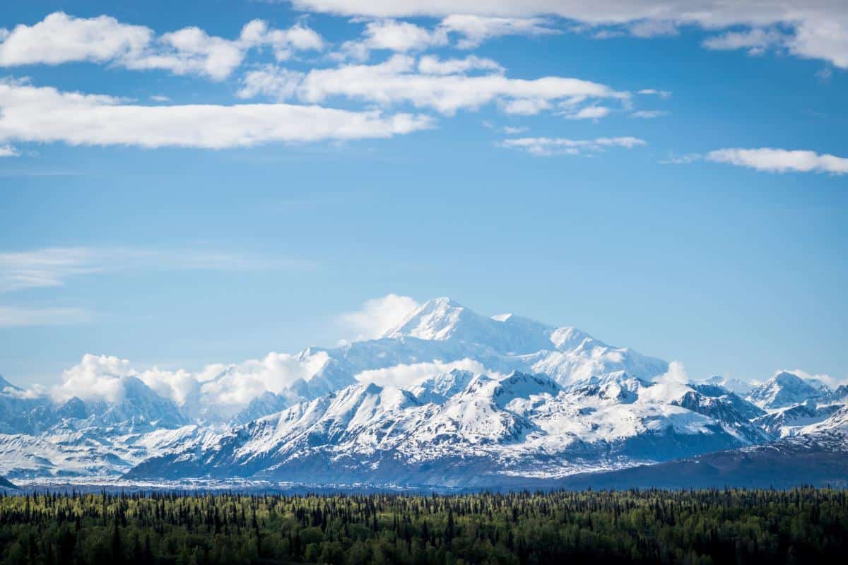
In addition to the major difference between their land areas, we also felt you could use some height comparisons, as well!
Mountain Ranges cut through Alaska’s wilderness stretching all the way from Southeast Alaska to the Arctic Ocean and Bering Sea, housing the highest peak in North America: Mount Denali (20,310 feet).
There are also the craggy peaks found within the Kenai Mountains, the Brooks Range, the Alaska Range, and the Wrangell-St. Elias Mountains among multiple other impressive ranges!
In Texas, the highest point is Guadalupe Peak which stands at a mere 8,751 feet. Not only in Alaska 2.25 larger in land area, it’s highest feature is also more than twice the size of Texas’.
Alaska vs Texas State Facts
Alaska
State Recognition: January 3, 1959
2024 Population: 733,536
State Size: 586,000 square miles
Capital City: Juneau
Largest City: Anchorage
International Airports: Anchorage, Fairbanks, Juneau, and Ketchikan
Texas
State Recognition: December 29, 1845
2024 Population: 30,976,800
State Size: 261,000 square miles
Capital City: Austin
Largest City: Houston
International Airports: Dallas, Houston, San Antonio, El Paso, Austin, McAllen, Harlingen, Edinburg, Corpus Christi, Fort Worth, Midland, Del Rio, Brownsville, and Lubbock
FAQ
In this last section, we’ve curated a list of the best size comparisons between Texas and Alaska among other states and countries to help you understand the size difference between these two massive regions.
How Much Bigger Is Alaska than Texas Compared to the U.S.?
Alaska’s massive size is not just an interesting fact about U.S. geography, it’s also a significant point of comparison when we consider the entire United States.
To give you a sense of scale, Alaska constitutes about 16% of the total land area of the U.S., which stands at approximately 3.8 million square miles. This means that Alaska alone is nearly one-fifth the size of the entire country!
To put this into a global context, if Alaska were an independent country, it would be the 20th largest country in the world after Mongolia and before Peru. Don’t forget that we’re only considering land area, which means we’re using 586,000 square miles for Alaska’s size.
As for Texas, a land area of 261,000 square miles only covers less than 7% of the country, which supports the 2.25x size difference between the two states.
How Much Texas Can Fit in Alaska?

To truly grasp the enormity of Alaska’s size compared to Texas, let’s talk numbers. If one were to divide Alaska’s massive land area by the size of Texas, you’d find that you could fit approximately 2.25 Texas’ into Alaska.
This calculation is based on Alaska’s 586,000 square mile area and Texas’s 261,000 square mile area. So mathematically speaking, there is enough room to snugly fit more than two entire states the size of Texas within the borders of Alaska.
If it’s hard to imagine what this may look like, you can use the map above for a visual!
How Many States Can Fit Into Alaska?
If we consider the United States as a whole, Alaska’s size is so grand that 19 of the smallest states could fit within its borders! Rhode Island, Delaware, Indiana, Connecticut, and several others would virtually disappear into Alaska’s expansive wilderness.
As the smallest state in the country with a land area of just 1,545 square miles, Rhode Island could essentially fit inside Alaska’s borders over 379 times!
Is Alaska Bigger Than Mexico?

No, Alaska is not bigger than Mexico. While Alaska’s land area is considerably larger than Texas, it falls short of Mexico’s size by over 175,000 square miles!
Mexico has a land area of approximately 761,000 square miles, while Alaska stands at 586,000 square miles. Despite being smaller than Mexico, Alaska still holds the title of the largest state in the U.S.
Is Alaska the Biggest State?
Without a doubt, Alaska is the biggest state in the United States. It surpasses all other states in terms of land area by a substantial margin.
With its vast wilderness and sparsely populated regions, Alaska stands alone at the top of the list, reigning supreme as the largest state in the country.
However, Alaska’s population remains comparatively small, leaving the state with vast untouched landscapes and endless potential for exploration. As we’ve discovered, while Texas may be bigger in terms of population and density, it can’t compete with Alaska’s sheer size.
What are the Three Largest States?
Alaska, Texas, and California are the three largest states in the U.S. Just considering land area (meaning, we aren’t counting square miles of water owned by each of these states), Alaska, as we now know, comes in first place with 586,000 square miles.
Texas is a far second with 261,000 square miles and California comes in third with just under 156,000 square miles.
How Does the Size of Texas Compare to Alaska and California Combined?
Combining the land areas of Alaska and California would make a land area equal to about 742,000 square miles, which is about 2.8 times the size of Texas.
California has an area of around 156,000 square miles and Alaska stands at 586,000 square miles, while Texas comes in at 261,000 square miles. Therefore, combining the land areas of Alaska and California would create a state significantly larger than Texas.
How Big is Alaska Compared to Europe?

Despite its vastness, Alaska’s 586,000 square miles are negligible in comparison to the entirety of Europe. The European continent, excluding its Asian-part territories like Russia and parts of Turkey, spans an impressive 3.9 million square miles.
Hence, Europe is nearly 6.7 times larger than Alaska. Europe’s colossal size encompasses a wide variety of cultures, climates, landscapes, and governments, standing in major contrast to the largely wild and uninhabited lands of Alaska.
What’s Bigger, California or Alaska?
Despite California being the third largest state in the U.S., Alaska is still significantly larger by about 430,000 square miles of land.
If you look at the map we provided above, you can see California on the far west coast of the country as long, narrow piece of land situated on the Pacific Ocean. When looked at next to Alaska, you will see how much larger the 49th state really is!
While Alaska is often overlooked due to its remote location separated from the contiguous U.S., its sheer size and unique characteristics make it an intriguing state to learn about and visit.
Alaska may be 2.25 times the size of Texas, but both state’s are still wonderfully unique and well worth visiting should you get the chance to visit either.
Up next, be sure to check out our Essential Guide to Traveling to Alaska for the First Time!


